Know Where Every Truck Is With GPS Tracking
See live and last known locations, understand every journey and use geofences and alerts to keep your fleet moving safely and efficiently.
STOP CHASING VEHICLES
Vehicle Tracking Without Calling the Driver
01
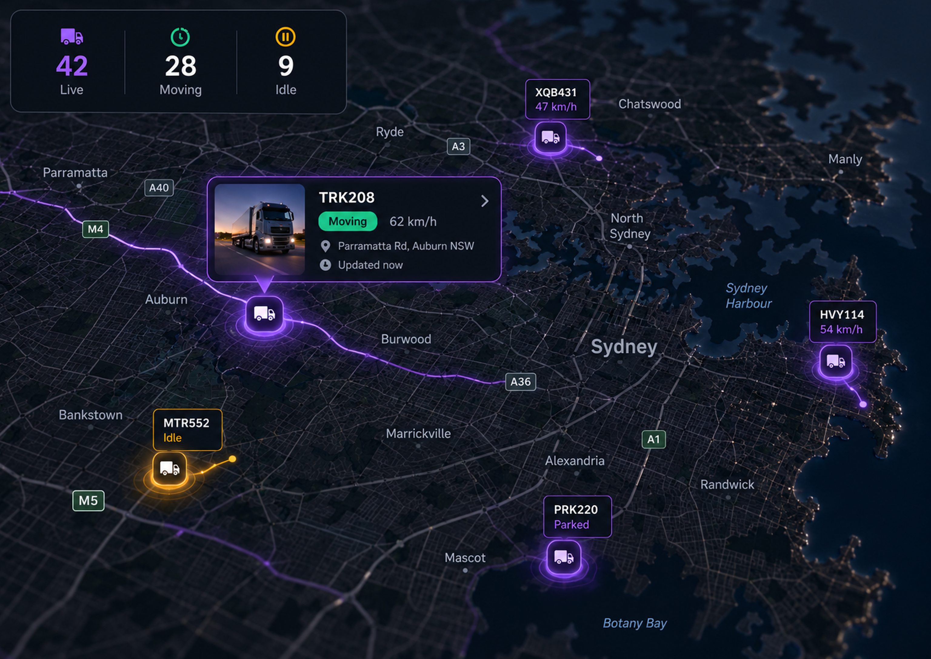
Fleet wide visibility
See every vehicle in real time, or its last known location when hardware is offline, without needing to call for an update.
02
Location history
Review every recorded trip, so you can see where a vehicle has been without reconstructing the journey afterwards.
03
Geofences and zones
Create virtual boundaries around depots, sites and customer locations, with alerts when vehicles enter or leave.
04
Movement alerts
Receive alerts for location and movement events that affect safety or productivity, so exceptions reach you without constant monitoring.
Fleet Visibility that Keeps You in Control
See the Whole Fleet at a Glance
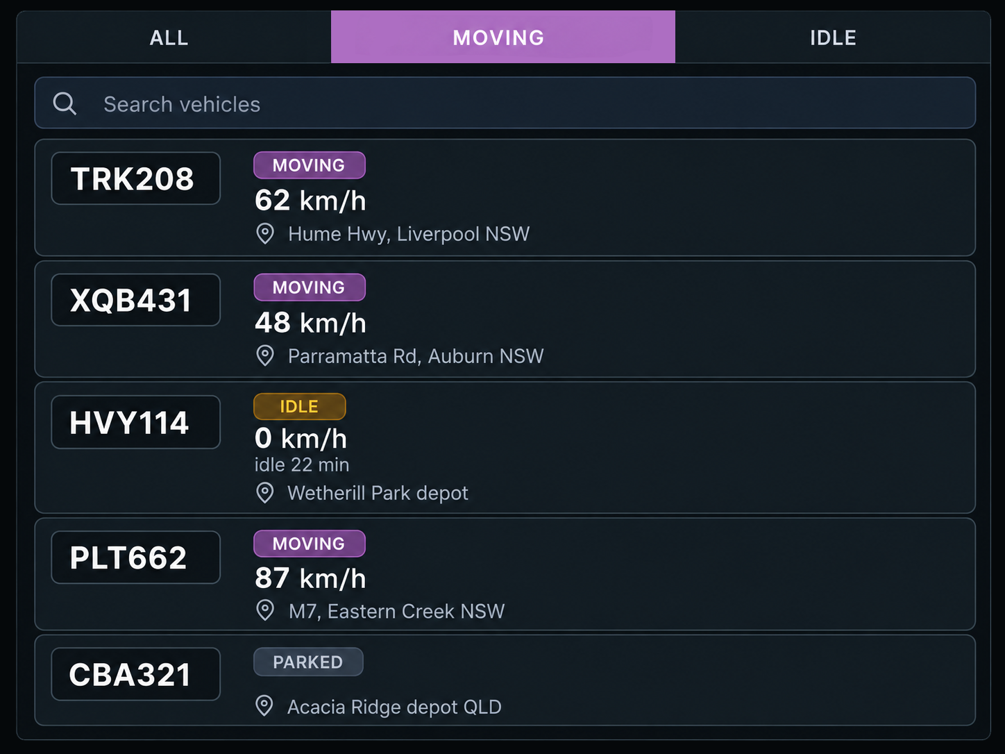
The Fleet List
Filter vehicles by moving, stopped, idle or offline, with speed, status, time and location shown for each. Jump straight to any vehicle for more detail.
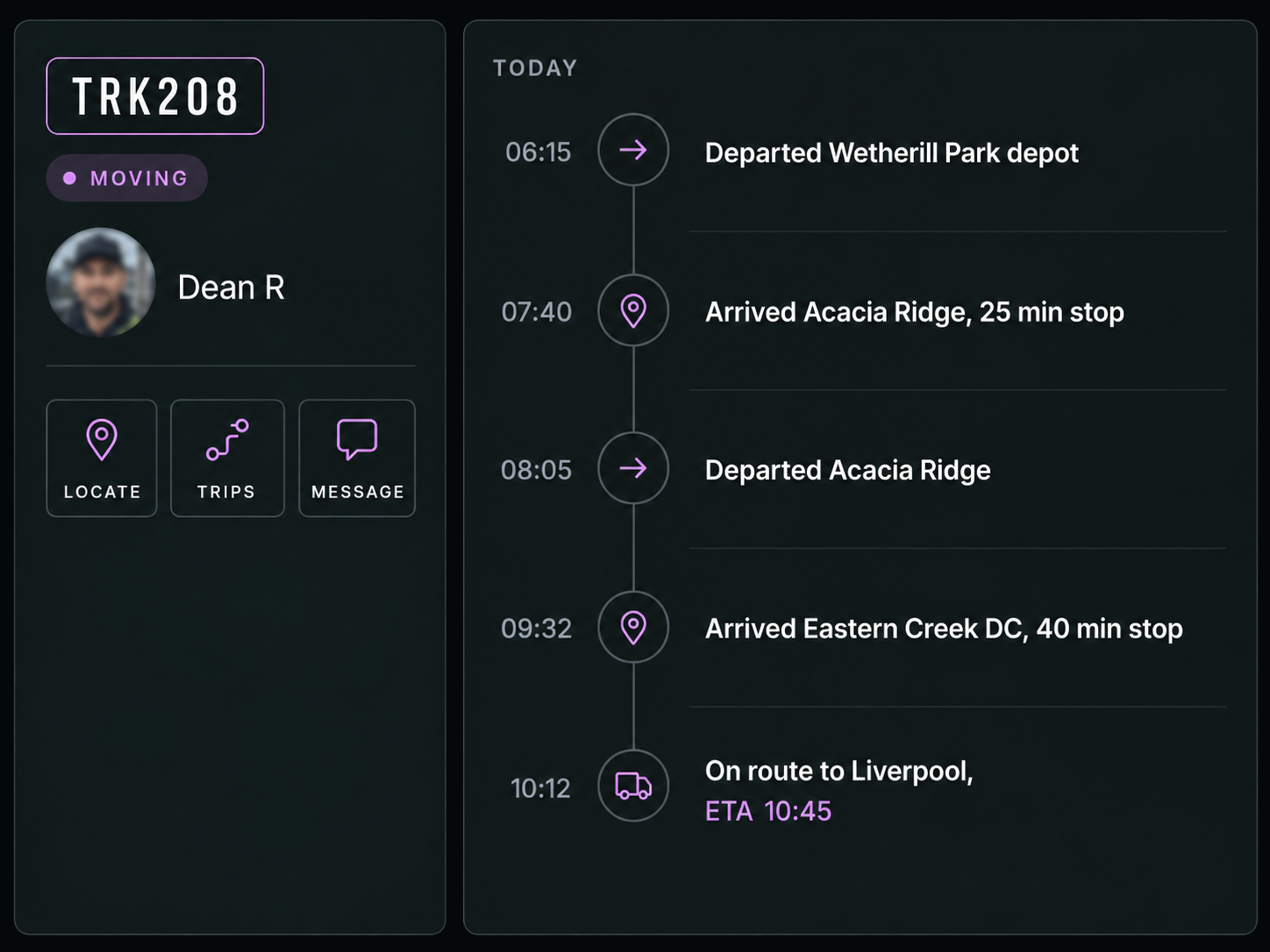
The Vehicle and its Day
See the driver, speed, heading, last update and location alongside street view, route replay and messaging. Review the day's trips as a timeline of departures and arrivals.
Every Journey, Mapped and Accounted For
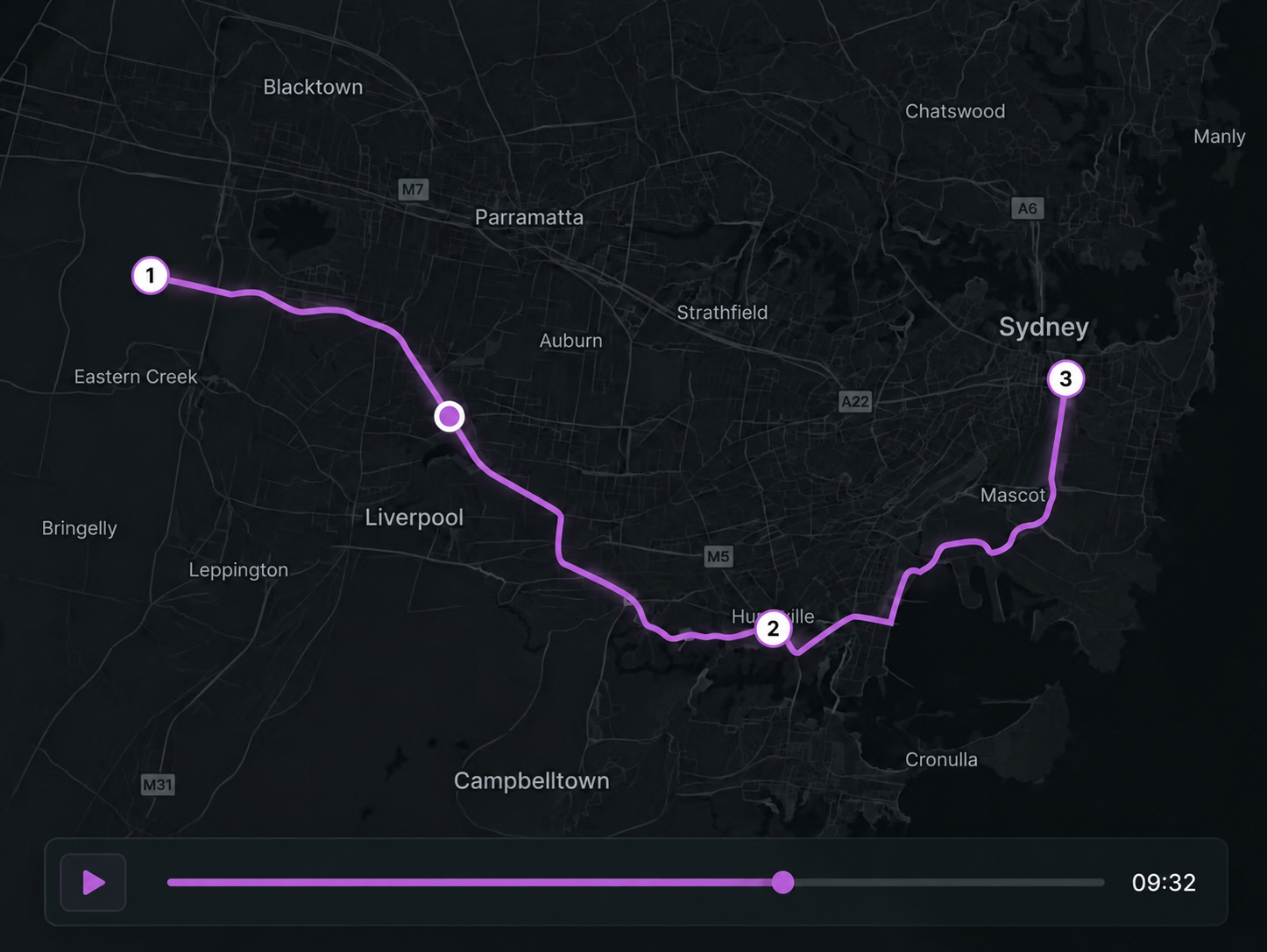
Trip history and playback
Replay the day to see every stop, start and waypoint mapped along the journey.
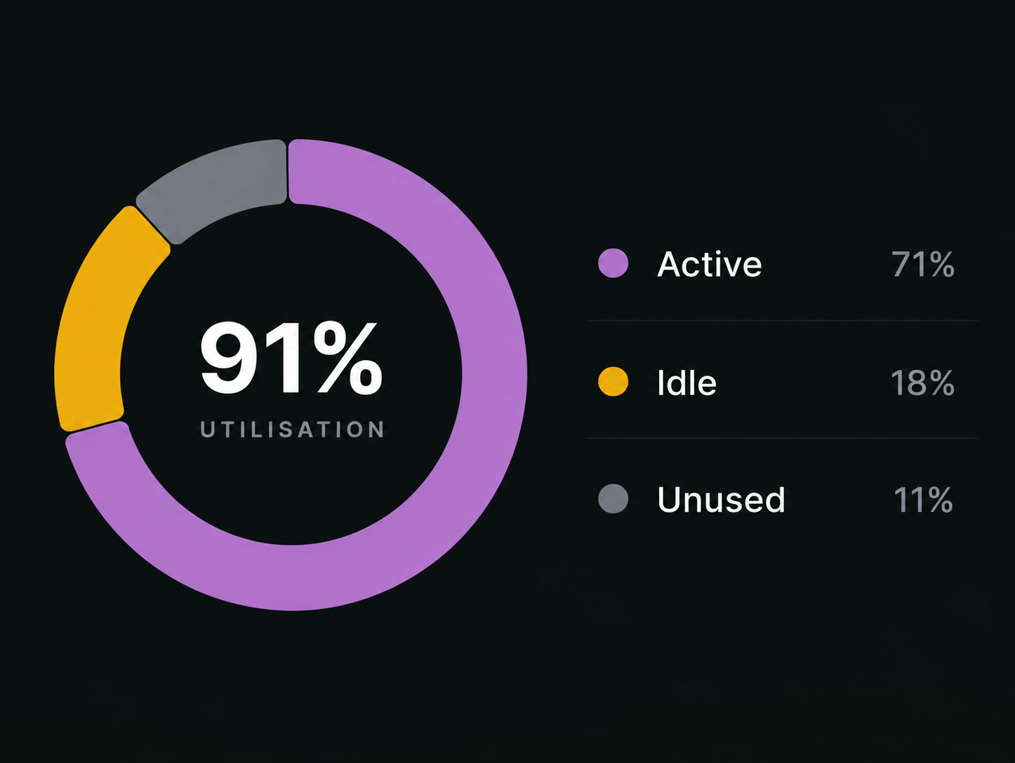
Fleet utilisation
See how vehicles are being used across active, idle and unused time, based on actual movement rather than the roster.
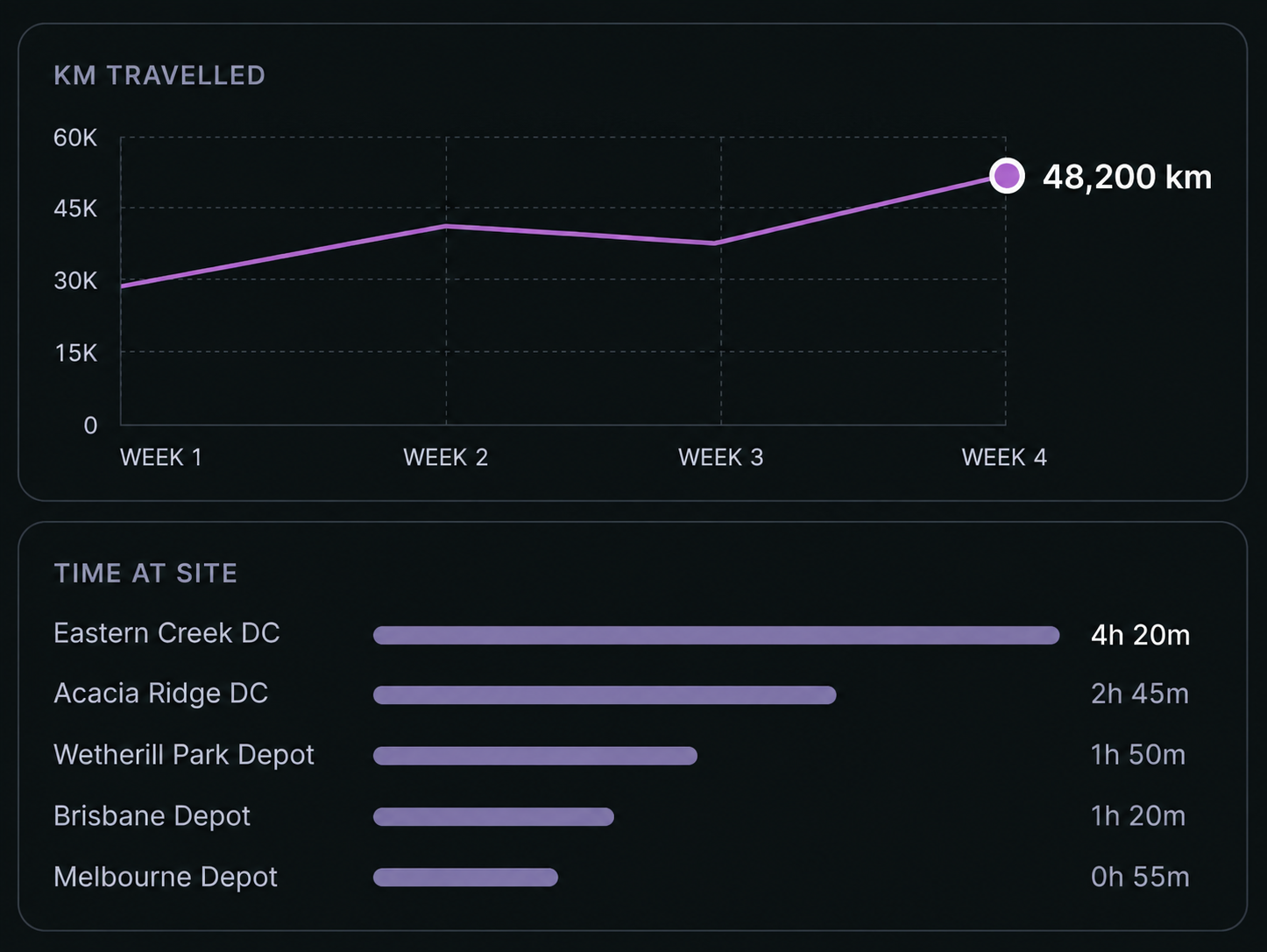
Location intelligence
Use location data to improve planning, productivity and customer service, with trends over time rather than isolated snapshots.
Additional features
Live Location
See every connected vehicle on the map in real time.
Last Known Location
See where a vehicle was last reported when live location is unavailable.
Vehicles Online
See the current online count and how it compares with yesterday.
Moving, Idle and Stopped
See vehicle status at a glance across the fleet.
Today's Trips
See trip volume and how it compares with the previous day.
Traffic overlay
View current traffic conditions alongside the fleet.
Geofence Entry and Exit
Get an alert when a vehicle crosses a defined boundary.
Speeding Alerts
Compare vehicle speed against the configured limit for its location.
Offline Alerts
Know when a device stops reporting.
Street View
See the surrounding location beyond the map pin.
Route Replay
Retrace a completed trip directly from the vehicle view.
Send Message
Contact the driver without leaving the map.
See Every Vehicle. Follow Every Journey.
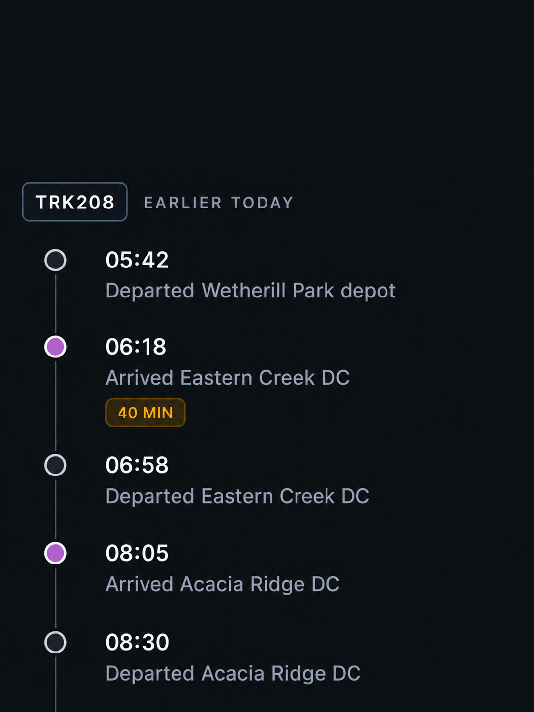
Earlier today
Replay the journey, stop by stop
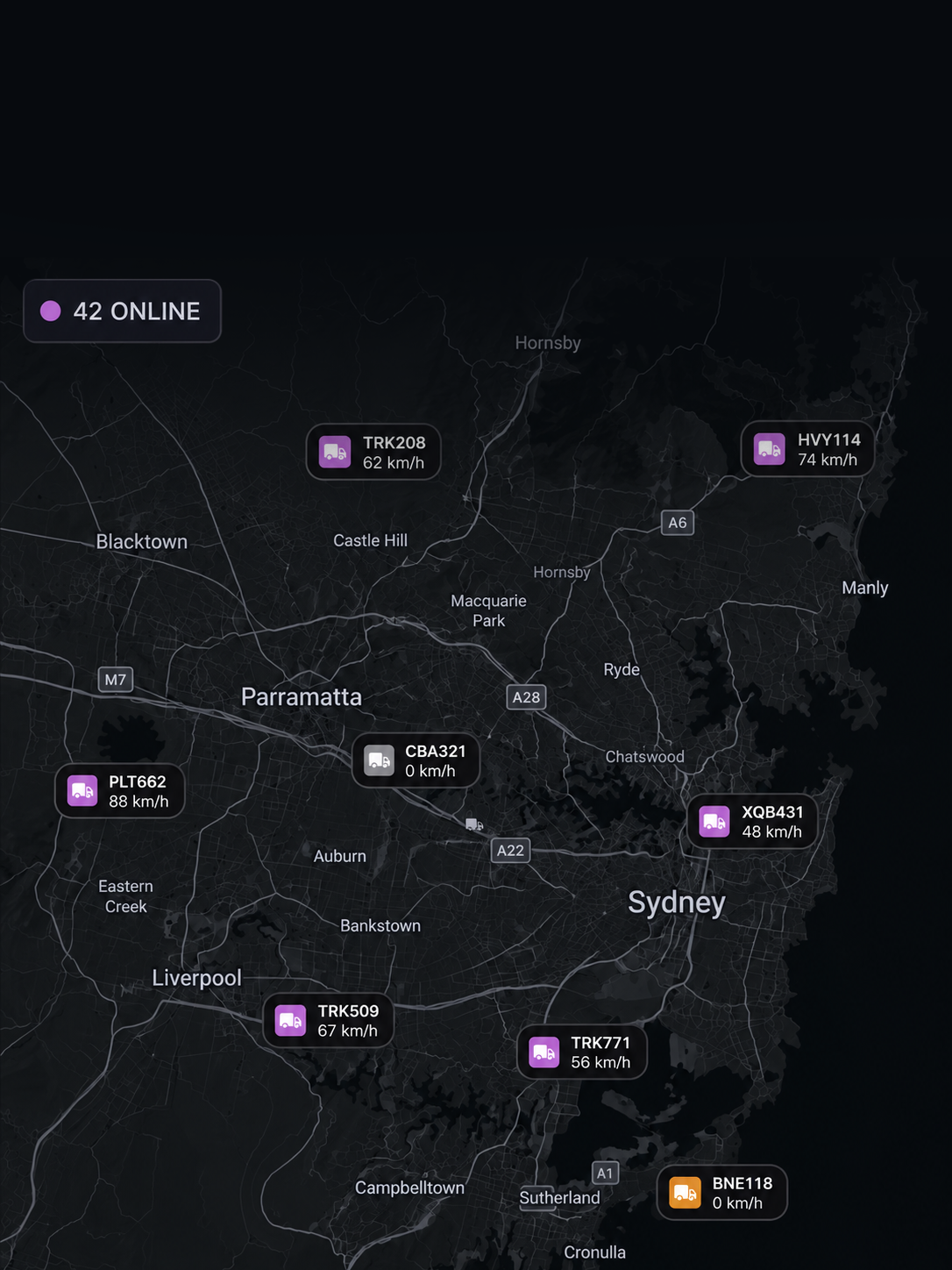
Right now
See every vehicle, live on the map
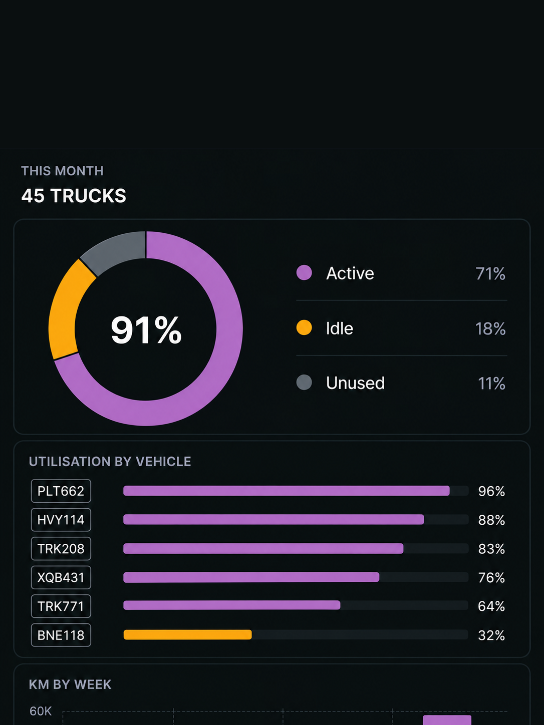
This month
See how the fleet is being used over time
Is tracking live or last known?
It depends on the connected hardware. Where live reporting is available, the vehicle is shown in real time. Otherwise, the map shows the last known location with its recorded time, so an old position is not presented as current.
What is a geofence used for?
A geofence creates a virtual boundary around a depot, site or customer location. Entry and exit can trigger alerts, turning arrivals and departures into recorded events.
How far back does trip history go?
Trips can be replayed with their stops, starts and waypoints. Retention follows your organisation's policy.
What alerts are available?
Location and movement alerts include geofence entry and exit, speeding against the configured zone limit and vehicles going offline. Each alert includes the vehicle, time and relevant context.
What does fleet utilisation show?
See how vehicles are actually being used across active, idle and unused time, giving fleet decisions a basis in movement data rather than the roster.
What hardware do I need?
A connected GPS tracker or telematics device. Available tracking features depend on the hardware fitted to each vehicle.
One Map. Every Vehicle. Live.
Live visibility, route history, geofences and alerts in one place.