GPS Fleet Tracking
Fleet Vehicle Tracking Built for Saudi Operations
See live and last known locations, understand every journey and use geofences and alerts to keep your fleet moving safely and efficiently across Saudi operations.
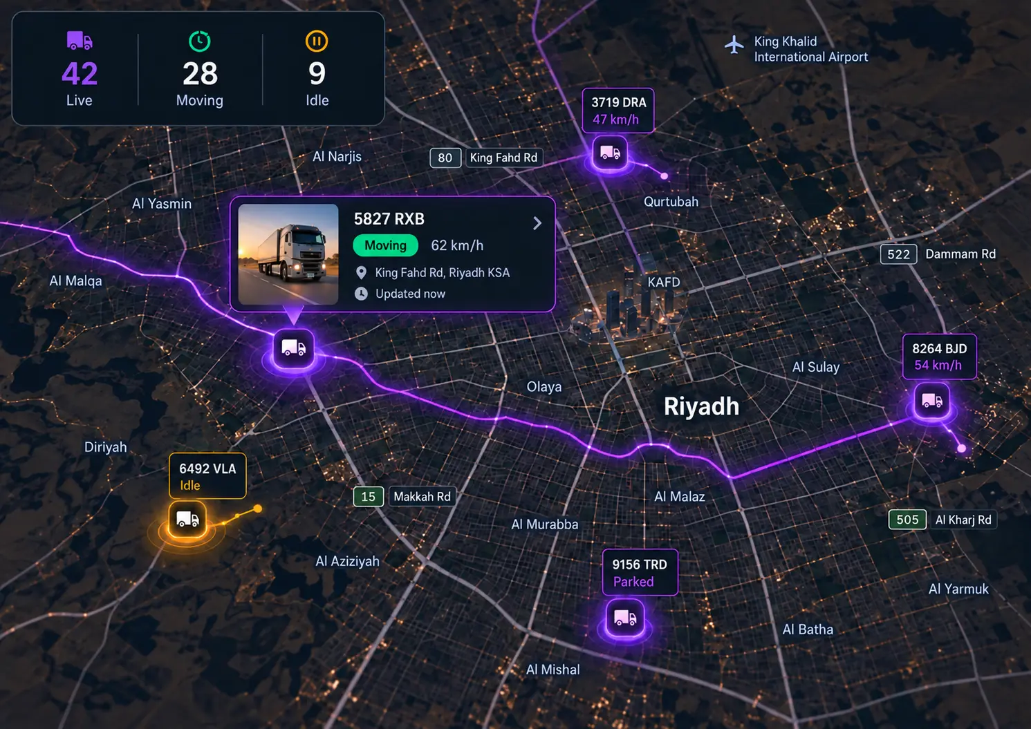
The Map Answers Before You Have to Ask
- Image coming soon
1Fleet wide visibility
See every vehicle in real time, or its last known location when hardware is offline, without needing to call for an update.
- Image coming soon
2Location history
Review every recorded trip, so you can see where a vehicle has been without reconstructing the journey afterwards.
- Image coming soon
3Geofences and zones
Create virtual boundaries around depots, customer sites, project locations and operating areas, with alerts when vehicles enter or leave.
- Image coming soon
4Movement alerts
Receive alerts for location and movement events that affect safety or productivity, so exceptions reach you without constant monitoring.
In detail
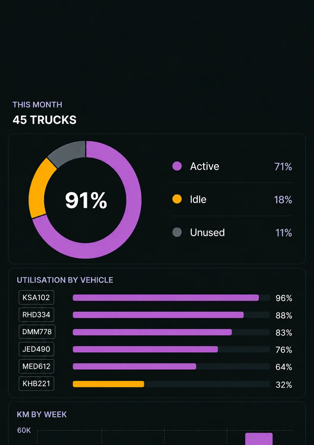
Utilisation, Assets and the Sites that Matter
Tracking That Fits Your World
No matter the industry or vehicle, our GPS solutions are designed to simplify operations, improve safety and empower smarter decisions.
Trusted by Industry Leaders
Saphyroo is trusted by established transport operators and operational teams who run high-volume, high-accountability work every day. That trust is built on outcomes: clearer visibility, stronger control, and evidence that stands up when questions are asked. Trusted by transport operators across Australia and Saudi Arabia with Riyadh-based onboarding and support.
Riyadh Based Support
Technology doesn’t fail. Rollouts fail. That’s why Saphyroo support is built around how Saudi fleets actually operate - multiple depots, mixed driver models, and daily pressure to protect ETAs. Our Riyadh team supports onboarding, configuration, and training so dispatch, supervisors, and drivers all follow the same workflow. You get practical guidance, not generic “software setup.” From first routes to live operations, we help teams adopt Route360 in a way that sticks - with clear processes your depots can run every day.
BUILT FOR SAUDI FLEET OPERATIONS
Keep Vehicle Visibility Connected Across the Kingdom
Keep vehicle location, journey history and tracking events connected across city, intercity, project and remote operations, giving teams a clearer view of where vehicles are and how they are moving.
Live & Last Known Location
Keep connected vehicles visible through live location data, with the last reported position available when live tracking is unavailable.
Journey & Movement History
Review recorded vehicle movements and completed journeys to understand where vehicles have travelled and when.
Geofences & Operating Areas
Create boundaries around depots, customer sites, project locations and operating areas to monitor vehicle arrivals, departures and movement.
Tracking Records
Keep relevant vehicle location, journey and tracking records organised for operational review and applicable transport requirements.
Saudi Tracking Requirements. Certain Saudi transport activities may be subject to TGA vehicle tracking requirements. Saphyroo helps operators keep relevant vehicle location, journey and tracking information connected and visible.
One Map. Every Vehicle. Live.
Live vehicle visibility, journey history, geofences and alerts in one place for fleet operations across Saudi Arabia.
We Have Answers
Coverage, contractor vehicles, geofences and onboarding in the Kingdom.
Talk to us about your operationDoes GPS tracking work reliably on long routes between Riyadh, Jeddah, and Dammam?
Yes. Drive360 is built for multi-city operations and long-distance visibility, so dispatch can track progress across intercity routes without relying on driver check-ins.
What happens in remote areas with weak coverage?
Events continue to be captured and sync once connectivity returns, so trip history and activity records stay complete even when signal drops.
Can we track contractor drivers and third-party vehicles?
Yes. You can track mixed fleets and contractor operations with the same live view, reporting, and geofence controls.
Can we set geofences for depots, customer sites, and restricted zones?
Yes. Create geofences around key locations and trigger entry and exit events, plus alerts for unexpected movement.
Can this help reduce delivery and service disputes?
Yes. Time and location records provide evidence of arrival, departure, and site time, linked to trips and activity.